> ## Documentation Index
> Fetch the complete documentation index at: https://docs.symmetry.com/llms.txt
> Use this file to discover all available pages before exploring further.
# Maps overview
> Look up applicable rates for one work address in Maps. Covers geospatial boundary display settings and how toggles change visualization only, not rates.
Maps allows clients to look up minimum wage rates applicable for an employee using a work address and visually see the geospatial boundaries that apply to each rate returned.
Maps is most effective when researching rates on a case-by-case basis.
## Maps settings
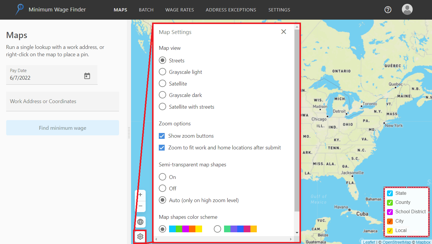
* Click the gear icon in the bottom left corner of the map to expand the settings, where you can adjust the map view (e.g., satellite, street, etc.) and customize how the geospatial boundaries are displayed.
* Choose which geospatial boundaries are displayed on the map by checking or unchecking the different boundaries found in the bottom right corner of the map.
 **Note on visual boundaries**
Turning off boundary visualizations does not impact wage rates returned. For example, if you uncheck "State”, the state boundary is no longer rendered on the map, but state wage rates (if applicable) will still be returned in the portal.
**Note on visual boundaries**
Turning off boundary visualizations does not impact wage rates returned. For example, if you uncheck "State”, the state boundary is no longer rendered on the map, but state wage rates (if applicable) will still be returned in the portal.